This website exposes the flat earth deception and proves that the earth is globe shaped.
Here’s a Before/After comparison of NOAA/NASA Suomi NPP #satellite true-color images of smoke from Southern California #wildfires igniting and burning yesterday. #ThomasFire #CreekFire #RyeFire
The fast-moving blazes are fueled by strong dry #SantaAnaWinds. The National Weather Service expects winds to continue for the next few days.
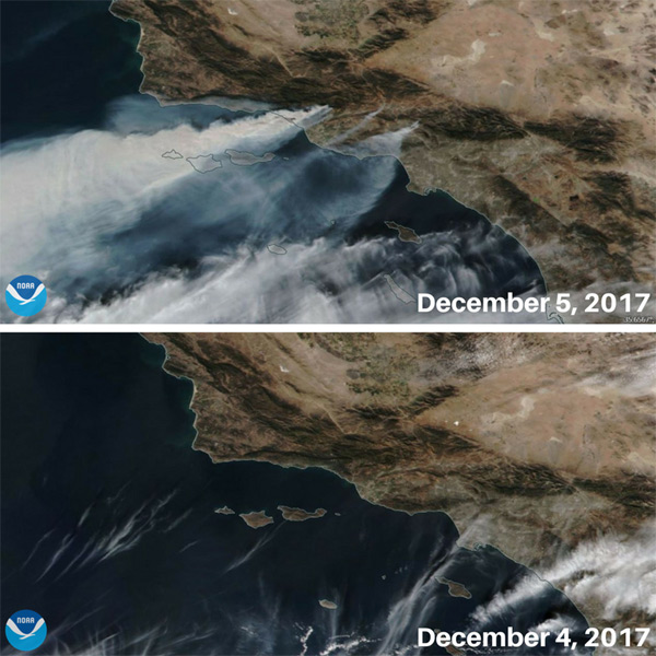
Although true-color images like this may appear to be photographs of Earth, they aren’t. They are created by combining data from the three color channels on the VIIRS instrument sensitive to the red, green and blue (or RGB) wavelengths of light into one composite image. In addition, data from several other channels are often also included to cancel out or correct atmospheric interference that may blur parts of the image.
To see more satellite imagery go to: https://www.nesdis.noaa.gov/content/imagery-and-data
Are we supposed to believe that images like this are taken by weather balloons, as flat earthers proclaim?