This website exposes the flat earth deception and proves that the earth is globe shaped.
Happy #FullDiskFriday! With the busy holiday season now upon us, we invite you to step back with us for a moment – approximately 22,300 miles – to marvel at the beauty of our planet.
To close out the week, we’re sharing today’s GOES-East full disk image of Earth, captured at 10:46 am ET, November 24, 2017.
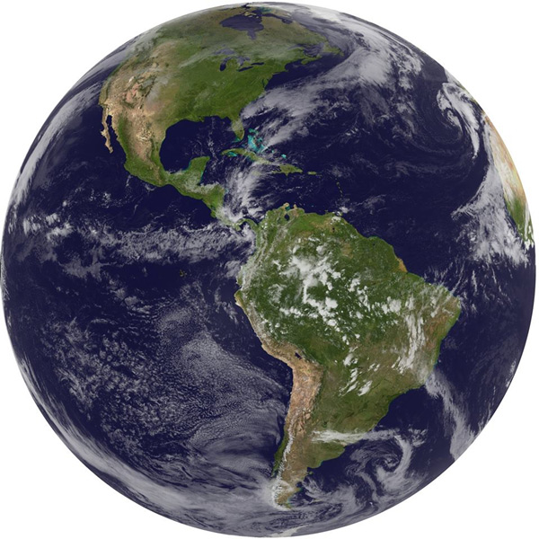
Also known as GOES-13, NOAA’s GOES-East satellite has been operational since April 2010. The satellite takes images of the Northern Hemisphere every 30 minutes and of the entire Western Hemisphere every 3 hours.
GOES-East is one of two geostationary satellites observing weather conditions in the U.S. Whereas GOES-East covers weather in the eastern continental U.S., the Atlantic Ocean and Gulf of Mexico, its counterpart – GOES-West – covers the western half of the U.S. and the eastern Pacific Ocean.
Data from GOES-13 will soon be replaced by NOAA’s GOES-16 satellite when it becomes fully operational in mid-December 2017.
For more Earth imagery, visit https://goo.gl/8hK8A1
Related Post: Satellites Prove The Flat Earth Deception
I know the Earth is round. When is someone going to use mirrors to flash across relative distances and elevations to show the effect of Earth’s curvature.
That’s a great idea Ray! I would like to have a powerful laser to shine across long distances, to use for experiments.